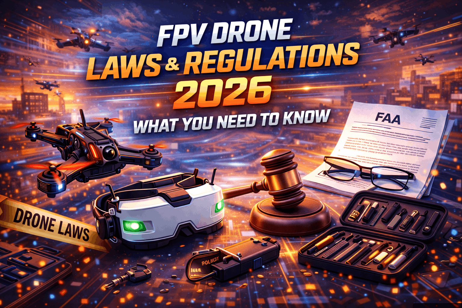
Introduction
Flying FPV drones in the United States operates under specific federal regulations enforced by the Federal Aviation Administration, supplemented by state and local laws that vary by jurisdiction. The regulatory landscape is complex and evolving, with rules covering registration requirements, airspace restrictions, operational limitations, and identification systems.
Understanding these regulations isn't just about avoiding fines—it's about operating safely and responsibly in shared airspace where manned aircraft, other drones, and public safety are at stake. The penalties for violations are real and substantial. The FAA has statutory authority to impose civil penalties up to $27,500 per violation for recreational operators and $32,666 per violation for commercial operators. Criminal penalties including equipment confiscation and imprisonment are possible for serious or repeated violations.
This comprehensive guide covers the complete regulatory framework for FPV drone operation in the United States as of 2026. You'll understand federal FAA requirements including registration, airspace classifications, operational rules, and Remote ID mandates. You'll learn about state and local regulations that add requirements beyond federal rules. You'll see the distinctions between recreational and commercial operations. Most importantly, you'll understand how to fly legally while still enjoying the hobby.
The regulatory environment continues evolving as drone technology advances and integration into national airspace increases. Rules that apply today may change tomorrow. This guide reflects regulations in effect as of 2026 but staying informed about regulatory changes is ongoing responsibility for all pilots.
Legal Disclaimer: I am not an attorney. This information is educational and should not be construed as legal advice. For specific legal questions or situations, consult with qualified aviation attorney familiar with drone regulations. Regulations change frequently—verify current requirements with FAA before flying.
Note: This guide contains affiliate links. If you purchase through our links, we may earn a commission at no extra cost to you. This helps support our testing and content creation.
Federal Aviation Administration (FAA) Jurisdiction
Why FAA Regulates Drones
The Federal Aviation Administration holds statutory authority over all aircraft operating in United States airspace. This authority extends to unmanned aircraft systems (UAS), the official term for what we commonly call drones.
The legal basis for FAA authority comes from the FAA Modernization and Reform Act of 2012 and subsequent legislation including the FAA Reauthorization Act of 2018. These laws grant FAA exclusive authority to regulate safety of national airspace system. No state or local government can contradict or supersede FAA safety regulations, though they can regulate other aspects like privacy or land use.
The integration challenge FAA faces is incorporating potentially millions of small unmanned aircraft into airspace shared with manned aviation including commercial airlines, general aviation, helicopters, and military aircraft. The regulations attempt to minimize collision risk while enabling legitimate drone operations.
Understanding FAA's role helps you recognize which rules come from federal authority versus state or local jurisdictions. FAA rules focus on aviation safety—airspace, altitude, operational procedures. State and local rules address property rights, privacy, noise, and other concerns outside FAA's aviation safety mission.
Regulatory Framework Overview
FAA regulations for recreational drone flying primarily come from 49 U.S.C. § 44809 (sometimes called "Exception for Limited Recreational Operations of Unmanned Aircraft") which was enacted as part of the FAA Reauthorization Act of 2018.
This statutory exception allows recreational operation without the stricter requirements applied to commercial operations, provided you follow specific limitations. These include flying for recreational purposes only, following community-based safety guidelines, keeping aircraft in visual line of sight, giving way to manned aircraft, flying in Class G airspace or with proper authorization in controlled airspace, and not interfering with emergency response operations.
Commercial operations fall under 14 CFR Part 107 (the "Small UAS Rule") which requires pilot certification, aircraft registration, operational limitations, and ongoing compliance. The distinction between recreational and commercial is critical because requirements differ substantially.
Registration Requirements
Weight Threshold and Exemptions
FAA requires registration of unmanned aircraft weighing more than 0.55 pounds (250 grams — see our sub-250g drone builds guide for options that avoid registration) and less than 55 pounds operated outdoors. The weight threshold includes everything flying—the aircraft, battery, camera, and any attachments at takeoff.
Drones under 0.55 pounds are exempt from registration when flown recreationally. This exemption covers tiny whoops and micro drones. However, even exempt drones must follow all other operational rules including airspace restrictions and altitude limits.
The 55-pound upper limit for recreational registration covers essentially all racing and freestyle FPV drones. Aircraft heavier than 55 pounds require different registration process and additional operational restrictions. Few FPV platforms approach this weight threshold.
For recreational pilots, single registration covers all aircraft you own for three-year period. You don't register each individual drone—you register once as pilot and apply the same registration number to all your aircraft. This simplifies compliance for pilots with multiple drones.
Registration Process Step-by-Step
Registration occurs through FAA's DroneZone website accessible at faadronezone.faa.gov. The process requires creating account, providing personal information, and paying registration fee.
Account creation asks for email address, password, and basic information including name, physical address, and date of birth. You must be at least 13 years old to register. Pilots under 13 must have parent or guardian register on their behalf.
Personal information verification requires providing address, phone number, and creating security questions. FAA uses this information to maintain registration database and contact you if needed. The address must be U.S. address—foreign nationals must use U.S. address where they maintain aircraft.
Payment processing accepts credit cards and costs five dollars for three-year registration period. This is nominal fee covering administrative costs. Registration expires three years from purchase date requiring renewal to maintain compliance.
Registration certificate is delivered electronically after payment processes. The certificate includes unique registration number beginning with "FA" followed by alphanumeric characters. This number must be displayed on all aircraft you operate.
The entire process takes approximately ten minutes for first-time registration. Renewal requires updating information and paying renewal fee, taking even less time.
Marking Requirements
Aircraft must display registration number in specific manner to be compliant. The marking must be visible without tools—no removing battery covers or access panels to see number.
Acceptable marking methods include permanent marker directly on airframe, printed label affixed to aircraft, or engraved into frame. The marking must be legible and durable enough to survive normal operation. Many pilots use printed labels covered with clear packing tape for durability.
Location flexibility allows marking anywhere on aircraft as long as it's externally visible without disassembly. Common locations include top plate, bottom plate, or battery bay visible when battery is removed. Some pilots mark both top and bottom for visibility regardless of aircraft orientation.
Size requirements specify marking must be large enough to be legible upon close visual inspection. FAA doesn't mandate specific font size but practical interpretation suggests quarter-inch high characters are adequate. Larger is acceptable and may be preferable for visibility.
The registration number must be marked on each aircraft you operate even though single registration covers all your drones. If you have five drones, all five must display the same registration number.
Renewal Process
Registration expires exactly three years from purchase date. FAA sends renewal reminders by email to address associated with account. Renewal requires logging into DroneZone, verifying information remains current, and paying five-dollar renewal fee.
Updated information should reflect any changes to address, phone number, or email. Maintaining current contact information ensures you receive important regulatory updates and renewal reminders.
Expired registration means operating illegally. While enforcement of expired registration is inconsistent, operating with expired registration during incident or accident creates liability issues and potential penalties. Set calendar reminder one month before expiration to ensure timely renewal.
Airspace Classifications and Restrictions
Understanding Airspace Classes
National airspace is divided into classes designated A through G, each with different characteristics and authorization requirements. Understanding these classifications is essential for legal flying.
Class A airspace extends from 18,000 feet MSL (mean sea level) up to 60,000 feet. This airspace is irrelevant for FPV drones since 400-foot altitude limit keeps drones well below Class A. No authorization for drone operation in Class A exists or is needed.
Class B airspace surrounds busiest airports with high volume of commercial traffic. This airspace typically extends from surface to 10,000 feet MSL in shape resembling upside-down wedding cake with wider airspace at higher altitudes. Major airports like Los Angeles, Chicago O'Hare, and Atlanta have Class B airspace. Drone operations in Class B are prohibited without explicit FAA authorization which is rarely granted.
Class C airspace surrounds airports with moderate traffic volume and control towers. This airspace typically extends from surface to 4,000 feet MSL in two-tier structure. Drone operations require air traffic control authorization through LAANC (Low Altitude Authorization and Notification Capability) system. Authorization can often be obtained quickly for appropriate altitudes and locations.
Class D airspace surrounds smaller airports with control towers. This airspace typically extends from surface to 2,500 feet MSL. Drone operations require air traffic control authorization. LAANC provides authorization at many Class D airports though some require direct coordination with tower.
Class E airspace is controlled airspace not designated as Class A, B, C, or D. Class E typically starts at 700 or 1,200 feet AGL in most areas, though some Class E extends to surface. Drone operations under 400 feet AGL typically occur in Class G airspace below Class E. When Class E extends to surface (common near airports), drone operations may require authorization depending on location and altitude.
Class G airspace is uncontrolled airspace not designated as Class A through E. Most FPV flying for recreation occurs in Class G airspace. No authorization is required to fly in Class G airspace, though all other rules including altitude limits and operational restrictions still apply.
Using LAANC for Airspace Authorization
LAANC provides nearly instant authorization to fly in controlled airspace at altitudes approved by air traffic control facilities. This system revolutionized recreational and commercial drone operations by replacing weeks-long manual authorization process with automated instant approvals.
LAANC works through approved third-party applications including AirMap, Aloft, Kittyhawk, and others. These applications access FAA facility maps showing maximum authorized altitudes in grid squares throughout controlled airspace. If your requested altitude and location fall within pre-approved limits, authorization is granted automatically.
Using LAANC requires downloading approved application, creating account, and submitting authorization request including location, altitude, date, and time. The application checks request against facility map. If within approved parameters, you receive authorization immediately typically valid for specific date and time window you requested.
Authorization limitations mean LAANC cannot override hard restrictions or approve flights outside facility map parameters. Some areas have zero-foot ceilings meaning no drone operations are authorized. Other areas may approve operations up to 50, 100, or 200 feet depending on proximity to airport and air traffic patterns.
The authorization is legally required permission to operate in controlled airspace. Flying without authorization in Class B, C, D, or surface Class E airspace where LAANC authorization is required constitutes violation subject to penalties.
Prohibited and Restricted Airspace
Certain areas are completely off-limits to drone operations regardless of authorization or purpose.
National parks prohibit drone operations under National Park Service regulations. The prohibition applies to takeoff and landing within park boundaries as well as flying over park land. Violating this prohibition can result in federal criminal charges. Some national forests, wilderness areas, and other federal lands have similar restrictions.
Military installations prohibit unauthorized drone operations within their boundaries and often in surrounding areas. Defense facilities create restricted airspace where any unauthorized aircraft entry creates serious security violation. The consequences of violating military restricted airspace can be severe including criminal charges.
Washington, D.C. has extensive restricted airspace including Special Flight Rules Area and Flight Restricted Zone making most drone operations illegal without specific authorization that is almost never granted to recreational operators. Flying drones in D.C. area requires understanding complex rules that change based on events and threat levels.
Temporary Flight Restrictions (TFRs) create dynamic no-fly zones for specific events, emergencies, or security situations. TFRs are published through NOTAMs (Notices to Airmen) and are enforceable for their duration. Examples include TFRs over wildfires, stadiums during major sporting events, presidential movements, and emergency response operations. Flying in active TFR without authorization is federal violation.
Checking Airspace Before Flying
Every flight begins with airspace check verifying your intended location is legal for drone operations. Several tools provide this information.
B4UFLY is FAA's official mobile application available for iOS and Android. The application provides location-based airspace information showing whether area is clear for operations, requires authorization, or is restricted. B4UFLY shows active TFRs and provides basic guidance on flying legally.
Aloft, AirMap, and Kittyhawk provide more detailed airspace information including LAANC authorization capabilities, detailed facility maps, and additional features. These applications are primary tools for pilots who fly regularly in varied locations.
Sectional charts available from FAA show detailed airspace information but require aviation knowledge to interpret correctly. These charts are official source of airspace classification data but are less accessible to recreational pilots than mobile applications.
The check must happen before every flight even if you've flown same location previously. TFRs create temporary restrictions. Airspace classifications can change. Facility maps are updated. What was legal last week might be restricted today.
Operational Rules and Limitations
Visual Line of Sight Requirement
The visual line of sight requirement mandates that pilot must be able to see aircraft with unaided vision throughout flight. Corrective lenses are permitted but binoculars, telescopes, or video feeds don't satisfy VLOS requirement.
This requirement creates apparent conflict with FPV flying where pilot sees through goggles rather than maintaining direct visual sight of aircraft. The regulatory requirement has not been modified to accommodate FPV operations, technically placing all FPV flying outside strict VLOS compliance.
The practical workaround employed by FPV community is using visual observer who maintains direct sight of aircraft while pilot operates via FPV goggles. This visual observer must be in direct communication with pilot and must be capable of seeing aircraft with unaided vision throughout flight.
The visual observer role isn't optional under strict regulatory interpretation—it's required method to achieve compliance while flying FPV. Many recreational pilots fly solo without visual observer particularly in open areas, but this technically violates VLOS requirement.
Enforcement of VLOS violation is inconsistent. Many pilots fly FPV solo for years without regulatory action. However, violation during incident or accident creates liability and potential penalties. Using visual observer eliminates this regulatory risk.
The regulation's intent is maintaining awareness of aircraft position and surroundings to avoid conflicts with manned aviation and other hazards. Whether this is better achieved through direct sight or FPV cameras is debatable, but current regulations require direct visual sight capability.
Altitude Limitations
Maximum altitude for recreational drone operations is 400 feet above ground level. The measurement is AGL not MSL meaning 400 feet above terrain or structure directly below aircraft, not above sea level.
This limitation keeps recreational drones below most manned aviation which operates at higher altitudes. General aviation typically flies above 500 feet AGL when not near airports. The 400-foot limit plus safety margin creates separation between drone and manned operations.
Exceptions to 400-foot limit allow operating up to 400 feet above structure when flying within 400-foot radius of that structure. This permits inspecting tall buildings or structures like towers while maintaining 400-foot altitude reference from structure rather than ground.
Altitude monitoring requires attention during flight. FPV OSD typically displays altitude above takeoff point. Adding 400 feet to your launch altitude tells you approximately where you are relative to AGL at that location. Terrain changes affect AGL calculation—flying over hill or valley changes your height above ground even if altitude above takeoff remains constant.
Violations of altitude limit are detectable through flight logs and data recorded by aircraft. Modern flight controllers log GPS altitude data. This data can be retrieved after accident or incident demonstrating altitude violations. Many pilots exceed 400 feet unintentionally due to excitement or lack of attention to OSD data.
Daylight Operation Requirements
Drone operations are restricted to official sunrise to official sunset timeframe. This means beginning morning civil twilight until end evening civil twilight, approximately 30 minutes before sunrise to 30 minutes after sunset.
Night operation for recreational pilots is prohibited without waiver. The waiver process for recreational operations is complex and rarely approved. Part 107 commercial operators can obtain night waivers more readily but recreational pilots effectively cannot fly at night legally.
The restriction aims to maintain visual line of sight which becomes impractical in darkness. Anti-collision lighting requirements for night operations apply to Part 107 night operations but recreational operations are simply prohibited rather than permitted with lighting.
Lighting on drone doesn't make night flying legal for recreational operations. Many pilots add LED strips or strobes improving visibility and safety but regulatory prohibition on night flying remains regardless of lighting.
Enforcement of night flying prohibition increases when incidents occur. A drone accident at night creates automatic violation even if accident was unrelated to darkness. The violation compounds any other issues from incident.
Manned Aircraft Right-of-Way
Drones must yield right-of-way to all manned aircraft at all times. This means if you see or hear airplane, helicopter, or other manned aircraft, you must maneuver to avoid conflict and land if necessary to ensure separation.
The operational practice when aircraft approaches is descending to low altitude or landing immediately. Don't assume manned aircraft sees your small drone. Don't assume you can safely maneuver around aircraft. The safe action is getting out of the way by descending or landing.
Reporting close encounters between drones and manned aircraft is encouraged when they occur. The FAA investigates reports of close encounters or conflicts. These investigations can result in regulatory action against drone operator if violation occurred.
The consequences of collision between drone and manned aircraft are potentially catastrophic. Even small drones can cause severe damage to aircraft engines, windscreens, or control surfaces. The liability for causing such incident includes criminal charges, civil liability, and potential imprisonment.
Flying Over People
Flying over people who are not participating in operation is prohibited under recreational rules. This means you cannot fly over crowds, public events, or individuals not involved in your operation.
Participating individuals are those who are directly involved in operation, have been briefed on risks, and can take shelter if needed. This typically means only you and your visual observer if present. Flying over your head while retrieving crashed drone might technically violate rule if you're not "participating" in that moment.
The restriction aims to prevent injuries from crashes or flyaways. Drones fail. Props break. Electronics malfunction. When this happens over uninvolved people, injury risk is unacceptable under recreational rules.
Enforcement focuses on egregious violations like flying over stadiums, concerts, or large gatherings. Flying over empty park where one jogger passes underneath is technically violation but unlikely to trigger enforcement unless incident occurs.
Remote ID Requirements
What Remote ID Is and Why It Exists
Remote ID is broadcast identification system similar to license plate for automobiles or ADS-B for manned aircraft. The system transmits aircraft location, altitude, speed, and identification information that can be received by FAA, law enforcement, and other authorized parties.
The regulatory purpose is creating accountability and enabling enforcement. When drone is observed flying illegally, Remote ID allows authorities to identify operator. Without Remote ID, untraceable drone operations make enforcement nearly impossible.
The implementation began in 2023 with full compliance required by September 2023 for new aircraft. Existing aircraft had until September 2023 to achieve compliance either through built-in Standard Remote ID or add-on Remote ID broadcast modules.
The technology uses WiFi or Bluetooth protocols to broadcast identification information. The transmission range is approximately 400 meters (about 1,300 feet) allowing ground-based receivers to detect operating drones within that radius.
Standard Remote ID vs. Broadcast Modules
Standard Remote ID is integrated into aircraft design during manufacturing. Many consumer drones from DJI, Autel, and other major manufacturers include Standard Remote ID meeting regulatory requirements without additional equipment.
Broadcast modules are add-on devices providing Remote ID compliance for aircraft without built-in capability. These modules connect to aircraft power and must have clear view of sky for GPS signal and clear transmission path for broadcast signal.
The modules vary in size, weight, and cost. Small modules weighing under 10 grams and costing $30-80 are available from manufacturers like DroneTag, BlueMark, and others. Installation involves mounting module on aircraft and connecting to power source.
Verification that your module is compliant requires checking FAA's list of approved Remote ID equipment. Only modules on FAA's Declaration of Compliance list meet regulatory requirements. Buying unlisted modules doesn't achieve compliance.
Custom-built racing and freestyle quads typically require broadcast modules since you're assembling components rather than buying manufactured aircraft with Standard Remote ID. The added weight of module (10-25 grams typical) affects flight characteristics minimally but must be accounted for in build.
Operating Without Remote ID
Limited exceptions to Remote ID requirement exist but are narrow in scope.
Flying at FAA-Recognized Identification Areas (FRIAs) allows operating without Remote ID. FRIAs are specific locations established by community-based organizations where members can fly without Remote ID. These are typically flying fields operated by established clubs.
Finding FRIAs requires checking FAA's published list. As of 2026, hundreds of FRIAs exist across United States primarily associated with Academy of Model Aeronautics (AMA) clubs and similar organizations. FRIA locations are published on FAA website and club websites.
Operating outside FRIAs without compliant Remote ID after compliance deadline constitutes violation subject to civil penalties. The enforcement priority for Remote ID violations is uncertain but regulatory requirement is clear.
The practical reality is many recreational pilots flying in remote areas away from airports and populated areas operate without Remote ID with minimal enforcement risk. However, this represents conscious decision to violate regulation rather than gray area interpretation.
Recreational vs. Commercial Operations
Defining Recreational Operations
Recreational operations are flying for fun, hobby, education, or personal enjoyment without any compensation or business purpose. The flight is purely for your own enjoyment with no commercial aspect.
Examples of clearly recreational flying include racing with friends, practicing freestyle tricks, aerial photography for personal use, flying at club events, and any flying motivated by personal enjoyment rather than compensation.
The compensation consideration is critical. If you receive anything of value for flying—money, goods, services, promotional consideration—operation is commercial regardless of how you describe it. Flying to help friend film property for sale crosses into commercial territory even if friend doesn't pay you.
Sharing aerial footage on YouTube or social media is generally recreational if you're not monetizing content. Once you monetize through ads, sponsors, or affiliate links, operation becomes commercial requiring Part 107 compliance.
The business purpose test asks whether flying serves business goal. Real estate agents flying to photograph listings are operating commercially even on their own properties. Wedding photographers capturing aerial footage are operating commercially even if couple are friends.
Part 107 Commercial Operations Overview
Commercial drone operations require Remote Pilot Certificate issued after passing FAA's Part 107 knowledge test. This test covers regulations, airspace, weather, operations, and other topics relevant to safe commercial UAS operation.
The certification process involves studying Part 107 material, scheduling and passing knowledge test at FAA-approved testing center, completing FAA application for Remote Pilot Certificate, and receiving permanent certificate after passing test and application approval.
Test cost is $175 paid at testing center. Study materials are available free from FAA or through commercial test prep courses costing $100-300. Total investment to achieve Part 107 certification runs $175-475 depending on study approach.
Operational privileges under Part 107 include flying for compensation, flying at night with appropriate training and anti-collision lighting, operating beyond visual line of sight with waiver, flying over people with certain aircraft categories, and requesting waivers for operations outside standard Part 107 limitations.
Operational restrictions under Part 107 include maintaining visual line of sight (unless waiver granted), maximum altitude 400 feet AGL (unless flying within 400 feet of structure), maximum groundspeed 100 mph, minimum visibility 3 statute miles, operating only in Class G airspace or with proper authorization, yielding right-of-way to manned aircraft, and not carrying hazardous materials.
The Part 107 certificate requires renewal every two years through online recurrent training rather than retaking knowledge test. This recurrent training ensures commercial pilots stay current with regulation changes.
When You Need Part 107
Determining whether operation requires Part 107 involves assessing whether any commercial element exists.
Situations clearly requiring Part 107 include real estate photography, construction site monitoring, agricultural surveying, infrastructure inspection, film and television production, promotional content creation for businesses, any operation where you're paid, and operations furthering business purpose even without direct payment.
Situations that are recreational include flying for fun at parks or fields, racing with friends without prizes exceeding nominal value, posting videos on non-monetized YouTube channel, photographing your own property for personal records, and learning to fly FPV.
Gray areas exist around monetized YouTube channels, affiliate marketing, and sponsored content. FAA has indicated that significant monetization likely requires Part 107 even if you're also flying recreationally. The safe approach is obtaining Part 107 if monetization becomes significant income source.
The violation consequences for operating commercially without Part 107 are substantial. Civil penalties up to $32,666 per violation can apply. Multiple flights constitute multiple violations. FAA has assessed tens of thousands of dollars in penalties against commercial operators flying without Part 107.
State and Local Regulations
State-Level Drone Laws
States cannot contradict FAA aviation safety regulations due to federal preemption but states can regulate aspects outside FAA's safety mission including privacy, property rights, surveillance, data collection, and criminal law applications.
California has extensive state drone laws addressing privacy, public safety, critical infrastructure, and harassment. California restricts drones near critical infrastructure, prohibits certain surveillance activities, and creates privacy protections against drone surveillance of persons or property.
Texas similarly restricts drone surveillance with detailed privacy protections. Texas law creates criminal offense for using drones to capture images of private property or individuals without consent for surveillance purposes.
Florida addresses drone operations over critical infrastructure creating criminal penalties for flying over designated facilities without authorization. Florida also restricts drone surveillance similar to other states.
New York regulates drones at state parks prohibiting operations in most state park lands without special permit. This creates significant practical limitation on flying in state park system despite being outside FAA's safety regulation domain.
Many states have enacted laws focused on specific concerns like interference with hunting, voyeurism and surveillance, harassment, interference with emergency operations, and weaponization. These state laws create legal obligations beyond federal FAA requirements.
Local Municipal Regulations
Cities and counties add another regulatory layer through local ordinances addressing land use, noise, public spaces, parks, and local concerns.
Park regulations commonly prohibit drone operations in municipal parks despite FAA airspace authority. These regulations apply to takeoff and landing within park property leveraging municipal authority over public property use. You cannot legally launch from or land in park prohibiting drones even if airspace above park is legally accessible.
Noise ordinances can restrict drone operations creating time-of-day limitations or decibel limits. While aircraft noise is generally FAA-regulated area, local noise ordinances sometimes apply to recreational drones depending on ordinance wording and interpretation.
Privacy ordinances in some municipalities restrict drone operations that might enable surveillance of private property. These ordinances create additional liability beyond state privacy laws.
The patchwork nature of local regulations means rules vary city to city. What's legal in one municipality may be prohibited in neighboring city. Traveling pilots must research local ordinances at every flying location.
Finding Applicable Local Laws
Researching local laws requires checking multiple sources since no comprehensive database consolidates all local drone regulations.
Municipal websites often have searchable ordinance databases. Searching terms like "unmanned aircraft," "drone," "UAS," or "model aircraft" can reveal applicable ordinances. Not all municipalities have digitized ordinances making research difficult.
Contacting local parks department provides information about park regulations. Many municipalities prohibit drones in parks without publishing regulations online. Phone calls or emails to parks officials clarify whether flying is permitted.
Local FPV clubs often know local regulations affecting their operations. Joining or contacting local clubs provides practical knowledge about where flying is permitted and what restrictions apply.
Legal research services like Municode or city clerk offices can help locate applicable ordinances if you're uncertain about local rules or need to verify information.
Privacy and Liability Considerations
Privacy Laws and Drone Operations
Privacy law intersection with drone operations is evolving area creating potential liability separate from aviation regulations.
Trespass and property rights issues arise when drones fly over private property at low altitudes. While FAA controls airspace, property owners have some rights to airspace immediately above their property. The exact boundary is unclear but flying low over property without permission creates potential trespass claims.
Surveillance and voyeurism laws protect against using drones to observe or record people where they have reasonable expectation of privacy. Flying over someone's backyard and recording through windows could constitute illegal surveillance in many states even if flight itself is otherwise legal.
Harassment using drones is prohibited in many jurisdictions. Repeatedly flying over same property or following individuals with drones can constitute harassment creating criminal or civil liability.
Data collection and use restrictions apply in some states when drones capture imagery or information about individuals or property. Using drone footage for commercial purposes without consent may violate publicity rights or privacy protections.
The safe practice is respecting privacy even when legal requirements are unclear. Don't fly low over property without permission. Don't point cameras at windows or private areas. Don't use drone footage that captures individuals in ways they wouldn't expect.
Liability Insurance
Liability insurance for drone operations is not legally required for recreational flying but is prudent risk management.
Homeowner's insurance may cover recreational drone liability but policies vary. Review policy carefully or contact insurance agent to determine if drone operations are covered. Many policies exclude aircraft including drones creating coverage gap.
Specialized drone insurance is available from companies like SkyWatch and LAANC Insurance providing coverage for recreational drone operations. Policies typically cover liability for property damage or bodily injury caused by drone operations.
The costs for recreational drone insurance run $100-300 annually for liability coverage of $1 million. This is small expense providing substantial protection against costly liability claims.
Part 107 commercial operations should always maintain commercial drone insurance. The liability exposure for commercial operations is greater than recreational flying making insurance nearly mandatory from business perspective even though not legally required.
AMA membership includes liability insurance for recreational operations conducted according to AMA safety guidelines at AMA-sanctioned fields. The coverage is limited but provides baseline protection for members flying at club events.
Consequences of Regulatory Violations
Civil Penalties
FAA can assess civil penalties for regulatory violations ranging from warning letters to maximum statutory penalties of $27,500 per violation for recreational operators and $32,666 per violation for commercial operators.
Enforcement discretion means FAA considers violation severity, prior history, cooperation, and circumstances when determining penalties. First-time minor violations with no safety impact often result in warning letters rather than monetary penalties.
Penalty amounts for monetary sanctions typically start at $1,100 for minor violations scaling upward based on severity. Multiple violations compound penalties. Operating commercially without Part 107 certification is treated seriously with penalties often in $10,000-30,000 range.
The enforcement process begins with investigation after incident, complaint, or FAA detection of violation. FAA notifies operator of alleged violation and proposed penalty. Operator can respond, request hearing, or settle. Most cases settle without formal hearing.
Payment of penalties is enforced through federal debt collection processes. Ignoring FAA penalties doesn't make them disappear. Unpaid penalties can result in collection actions, credit damage, and additional legal complications.
Criminal Penalties
Criminal prosecution is possible for serious violations, reckless operation, or interference with manned aircraft.
Reckless operation creating serious safety risk can result in federal criminal charges under 18 U.S.C. § 39B making it criminal to knowingly operate unmanned aircraft in manner that interferes with or disrupts operation of manned aircraft. Maximum penalty is one year imprisonment.
Interference with law enforcement or emergency operations can trigger state and federal criminal charges depending on circumstances. Flying drone near active wildfire suppression, police operations, or emergency response creates serious criminal liability.
Restricted airspace violations such as flying in Washington D.C. Flight Restricted Zone or near military facilities can result in federal criminal charges given national security implications.
The cases prosecuted criminally typically involve egregious conduct—flying near airports with intent to interfere, operating during emergencies despite warnings, or flying in highly sensitive areas. Casual recreational violations rarely result in criminal charges absent aggravating circumstances.
Equipment Confiscation
Law enforcement can confiscate drones involved in violations or crimes. The confiscation may be temporary during investigation or permanent as result of enforcement action or criminal conviction.
Recovery of confiscated equipment requires resolving underlying violation, paying penalties if assessed, and following administrative process for equipment return. There's no guarantee of equipment return even after penalties are paid if equipment was used in serious violation.
Practical approach to avoiding confiscation is following regulations and cooperating with law enforcement if questioned. Hostile confrontations escalate situations unnecessarily. Polite cooperation and compliance with lawful requests prevents turning minor issue into major conflict.
Best Practices for Legal Compliance
Pre-Flight Checklist for Legal Operations
Systematic pre-flight checklist ensures compliance with relevant regulations and avoids preventable violations.
Verify aircraft registration is current by checking expiration date on registration certificate. Renew if within 30 days of expiration. Confirm aircraft displays registration number visibly.
Check airspace using B4UFLY or similar application confirming location is authorized for operation. Verify no TFRs are active. If authorization required, obtain LAANC approval before flying.
Confirm Remote ID compliance by verifying aircraft has working Remote ID broadcast. Test if possible to ensure transmission is functioning. If flying at FRIA, verify location is on approved FRIA list.
Review local regulations and restrictions checking municipal websites or contacting local authorities if uncertain. Verify parks or public lands permit drone operations if flying in those areas.
Plan operation during legal hours between sunrise and sunset. Check exact sunrise and sunset times adjusting for civil twilight allowances.
Arrange visual observer if flying FPV to maintain VLOS compliance. Brief observer on their responsibilities and establish communication method.
Review weather ensuring visibility meets requirements and conditions are safe for operations.
Staying Current with Regulation Changes
Regulatory environment evolves as FAA updates rules, Congress passes new legislation, and courts interpret existing laws. Staying informed prevents violating new requirements you didn't know existed.
FAA communications include DroneZone email updates, FAA UAS website information, and FAA social media channels. Sign up for email notifications through DroneZone account.
Industry publications like sUAS News, AUVSI, and DroneLife cover regulatory developments affecting recreational and commercial operators.
Local club newsletters and meetings often discuss regulatory changes affecting local flying. Active clubs track relevant regulations and share information with members.
Legal resources including aviation attorneys who blog or publish about drone law provide expert interpretation of regulations. Following these sources provides deeper understanding of regulatory nuances.
The regulatory review cycle means checking periodically for updates rather than assuming rules remain static. Set quarterly reminder to review FAA website and industry news for regulatory changes.
Future Regulatory Developments
Anticipated Changes
The regulatory framework continues evolving as drone operations expand and integrate further into national airspace system.
Traffic management systems for drones (UTM) are under development creating automated systems for drone flight coordination similar to air traffic control for manned aircraft. These systems will eventually enable beyond visual line of sight operations and higher-density drone operations in urban areas.
Expanded automated authorization through enhanced LAANC systems will provide more locations and altitudes where instant authorization is available. This expansion improves access to controlled airspace while maintaining safety.
Certification requirements for recreational operators may be introduced requiring knowledge testing similar to Part 107 but tailored to recreational operations. This could replace current registration-only requirement with actual competency assessment.
Operational limitations in Part 107 may be relaxed including higher altitude ceilings in specific circumstances, reduced visibility minimums with appropriate equipment, and streamlined waiver processes for operations beyond current limits.
Remote ID system evolution will likely include more comprehensive identification requirements, integration with traffic management systems, and potentially mandatory position tracking rather than just broadcast identification.
Advocacy and Community Input
The regulatory process includes public comment periods where individuals and organizations can provide input on proposed rule changes.
Notice of Proposed Rulemaking (NPRM) is published in Federal Register when FAA proposes new regulations or significant changes to existing rules. The NPRM includes proposed rule text and explanation.
Public comment period typically lasts 30-90 days during which anyone can submit comments on proposed rule. Comments should be substantive addressing specific aspects of proposal with reasoning and evidence supporting your position.
Industry organizations including Academy of Model Aeronautics (AMA) and Recreational Aviation Foundation (RAF) represent recreational pilots' interests in regulatory processes. These organizations submit formal comments and advocate for policies supporting recreational flying.
Personal participation in comment process involves monitoring FAA rulemaking activities, reading proposed rules when published, submitting thoughtful comments during comment periods, and encouraging other pilots to participate in process.
The effectiveness of public comment varies but well-reasoned substantive comments can influence final rules. FAA must consider all comments received and address significant issues raised.
Conclusion
Operating FPV drones legally in United States requires understanding and following multi-layered regulatory framework. Federal FAA regulations establish baseline requirements including registration, airspace authorization, operational limitations, and Remote ID compliance. State and local laws add privacy protections, land use restrictions, and other requirements beyond federal aviation safety rules.
The distinction between recreational and commercial operations is critical with substantially different requirements for each. Recreational flying under 44809 exception allows operation without pilot certification but requires following specific limitations. Commercial operations require Part 107 certification but provide more operational flexibility with appropriate waivers.
Compliance protects you from civil penalties up to $27,500 per violation, criminal prosecution for serious violations, and equipment confiscation. Beyond regulatory consequences, following rules reduces risk to manned aviation, prevents injuries to uninvolved people, respects privacy and property rights, and maintains positive public perception of hobby.
The regulatory environment evolves continuously requiring ongoing attention to changes and updates. Resources including FAA communications, industry publications, and local clubs help you stay current with applicable requirements.
Flying legally enables enjoying hobby without looking over shoulder for enforcement. Taking time to understand requirements, register properly, check airspace before every flight, respect altitude and operational limits, and maintain Remote ID compliance creates foundation for years of legal compliant flying.
For equipment recommendations that support legal operations, see our goggles guide. Planning to fly abroad? Our international FPV travel guide covers regulations by country, and beginner guide. For understanding costs of legal compliant setup including Remote ID modules, see our setup cost guide. If you need commercial certification, our Part 107 study guide walks through the exam prep.
FAQ - FPV Drone Laws and Regulations
Q: Do I need to register my FPV drone with the FAA?
Yes, if your drone weighs more than 0.55 pounds (250 grams) including battery and all equipment at takeoff. This includes essentially all racing and freestyle FPV drones except tiny whoops. Registration costs $5 for three-year period through FAA DroneZone website (faadronezone.faa.gov). Process takes approximately 10 minutes. You receive registration number that must be displayed on all aircraft you operate. Single registration covers all drones you own. Drones under 0.55 pounds flown recreationally are exempt from registration but must still follow all operational rules.
Q: Can I fly FPV legally or does it violate visual line of sight rules?
FPV flying creates regulatory gray area regarding visual line of sight (VLOS) requirement. Regulations require pilot to maintain direct visual sight of aircraft with unaided vision (corrective lenses allowed). Flying through goggles doesn't satisfy this requirement. The compliant solution is using visual observer who maintains direct sight of aircraft while pilot operates via FPV. Visual observer must be in communication with pilot and capable of seeing aircraft throughout flight. Many recreational pilots fly solo FPV especially in remote areas, but this technically violates VLOS requirement. Using visual observer eliminates regulatory risk.
Q: How do I check if it's legal to fly in my area?
Download FAA's B4UFLY mobile app (iOS or Android) or use applications like Aloft or AirMap. Enter your intended flying location and app shows whether area is clear for operations, requires authorization, or is restricted. Check for Temporary Flight Restrictions (TFRs) that create dynamic no-fly zones. Verify local regulations by checking municipal websites or contacting parks department—many cities prohibit drone operations in parks despite FAA airspace being clear. Check before every flight even if you've flown location before because TFRs and restrictions change. If controlled airspace requires authorization, use LAANC system for instant approval if available.
Q: What is Remote ID and do I need it?
Remote ID is broadcast identification system transmitting aircraft location, altitude, and identification information similar to license plate for cars. Required for all drones operating in most areas unless flying at FAA-Recognized Identification Area (FRIA). Many consumer drones from DJI and other manufacturers include Remote ID built-in (Standard Remote ID). Custom-built racing quads typically need add-on broadcast module costing $30-80 and weighing 10-25 grams. Modules must be on FAA's approved list. Operating without compliant Remote ID after September 2023 deadline constitutes violation subject to penalties. FRIAs are specific flying fields where operations without Remote ID are permitted—check FAA website for FRIA locations.
Q: Can I fly at night with lights on my drone?
No. Recreational drone operations are prohibited from official sunset to official sunrise regardless of lighting on aircraft. This restriction applies to twilight periods approximately 30 minutes before sunrise and after sunset. Night waivers for recreational operations are not routinely granted. Part 107 commercial operators can obtain night flying authorization with appropriate training and anti-collision lighting but recreational pilots cannot fly legally at night. Violation of night flying restriction creates liability particularly if incident occurs. Adding lights improves visibility but doesn't make night flying legal for recreational operations.
Q: What's the maximum altitude I can fly my FPV drone?
Maximum altitude for recreational drone operations is 400 feet above ground level (AGL). Measurement is from terrain or structure directly below aircraft, not from takeoff point. Exception allows flying up to 400 feet above structure when within 400-foot radius of that structure. FPV OSD typically displays altitude above takeoff point—add 400 feet to determine where you are relative to AGL limits. Flying over terrain changes affects AGL even if altitude above takeoff is constant. Violations are detectable through flight logs recorded by modern flight controllers. Exceeding 400 feet AGL is regulatory violation subject to penalties.
Q: Do I need a license to fly FPV drones recreationally?
No pilot certification is required for recreational flying under 49 U.S.C. § 44809 exception. You must register aircraft if over 0.55 pounds ($5 for three years) but no knowledge test or pilot certification is needed. However, commercial operations (flying for any compensation or business purpose) require Remote Pilot Certificate under Part 107 obtained by passing FAA knowledge test ($175 plus study materials). Even unpaid flying that serves business purpose may require Part 107. Monetizing YouTube videos or accepting any compensation for flying crosses into commercial territory requiring Part 107 certification.
Q: Can I fly my drone in national parks?
No. National Park Service prohibits drone operations including takeoff, landing, and flying over national park lands. This prohibition is separate from FAA airspace rules and applies under NPS authority over park lands. Violation can result in federal criminal charges. Many national forests, wilderness areas, and state parks have similar restrictions. Always check land management agency rules before flying on public lands. Flying from location outside park boundary over park land still violates prohibition. Many beautiful scenic areas are national parks making this restriction frustrating but enforcement is active and penalties are real.
Q: What happens if I fly in restricted airspace accidentally?
Stop flying immediately and land safely when you realize you're in restricted airspace. Accidental brief incursion without incident rarely results in enforcement action if you land promptly. However, continuing to fly after becoming aware creates knowing violation with greater consequences. Serious violations in controlled airspace near airports, over restricted military facilities, or in Washington D.C. flight restricted zone can result in investigation, civil penalties up to $27,500, criminal charges, and equipment confiscation. Always check airspace before every flight using B4UFLY or similar app to prevent accidental violations. If you do violate accidentally, land immediately and don't repeat mistake.
Q: Do state and local laws apply in addition to FAA regulations?
Yes. FAA regulations establish minimum baseline requirements focused on aviation safety that preempt contradictory state and local laws. However, states and cities can regulate aspects outside FAA's aviation safety mission including privacy, surveillance, property rights, trespassing, harassment, noise, and land use. Many states have drone-specific privacy laws. Many cities prohibit drone operations in municipal parks through property use authority. You must comply with FAA federal regulations AND applicable state and local laws. Research local ordinances before flying in new location since rules vary significantly between jurisdictions.
Q: Can I fly my FPV drone anywhere in Class G airspace?
Class G (uncontrolled) airspace generally allows drone operations without FAA authorization but all other rules still apply including 400-foot altitude limit, visual line of sight requirement, daylight operations only, and Remote ID. Additionally, land use restrictions may prohibit takeoff/landing even if airspace is clear. You cannot launch from or land in areas prohibiting drones (like parks with drone bans) even if airspace above is Class G. Private property owners can prohibit drone operations over their property. Just because airspace is unrestricted doesn't mean you can fly anywhere—consider land use, property rights, and local regulations in addition to airspace classification.
Q: How much are fines for breaking drone regulations?
Civil penalties for recreational operators can reach $27,500 per violation (commercial operators face up to $32,666 per violation). Actual penalties assessed depend on violation severity, prior history, and circumstances. Minor first-time violations often result in warning letters rather than monetary penalties. Substantial penalties ($1,100-$10,000+) are assessed for violations creating safety risk, commercial operations without Part 107 certification, repeated violations, or flying in restricted airspace. Multiple violations constitute multiple penalties. Criminal penalties including imprisonment are possible for serious violations like interfering with manned aircraft or flying in highly restricted areas. Equipment confiscation can occur in addition to monetary penalties.
Q: What's the difference between recreational and commercial drone flying?
Recreational flying is operating purely for fun, hobby, or personal enjoyment without compensation or business purpose. Commercial flying is any operation involving compensation (money, goods, services) or furthering business goal. Examples of commercial operations include real estate photography, construction monitoring, promotional content for businesses, monetized YouTube channels with substantial income, and any flying where you're paid. Commercial operations require Part 107 Remote Pilot Certificate ($175 test plus study materials). Penalties for operating commercially without Part 107 can exceed $30,000. If you're unsure whether operation is commercial, safest approach is obtaining Part 107 certification.
Q: Do I need insurance to fly FPV drones?
Liability insurance is not legally required for recreational drone operations but is highly recommended. Homeowner's insurance may cover recreational drone operations but many policies exclude aircraft. Specialized drone insurance costs $100-300 annually for $1 million liability coverage. Commercial Part 107 operations should always maintain insurance given greater liability exposure. Academy of Model Aeronautics (AMA) membership includes liability insurance for operations at AMA-sanctioned fields following AMA guidelines. Without insurance, you're personally liable for any property damage or injuries caused by drone operations. Given low cost and substantial protection, insurance is prudent investment for active pilots.
Q: Can I fly FPV drone from my backyard?
Depends on location. Check three things: First, verify airspace using B4UFLY app—controlled airspace may require authorization even for backyard. Second, check local ordinances—some cities restrict residential drone operations through noise or nuisance ordinances. Third, respect neighbors' property and privacy—flying over neighboring property at low altitude creates trespassing and privacy concerns. If your property is in Class G airspace with no local restrictions and you respect neighbors' privacy, backyard flying is generally legal for recreational operations. However, takeoff/landing from your property while flying over surrounding neighborhood creates privacy and property rights issues. Be considerate of neighbors even when technically legal.
Q: Where can I find official current FAA drone regulations?
FAA maintains official drone information at faa.gov/uas with recreational flying guidance at faa.gov/uas/recreational_fliers. Regulations are codified in Title 14 Code of Federal Regulations (14 CFR) including Part 107 for commercial operations. Recreational flying exception is in 49 U.S.C. § 44809. FAA DroneZone (faadronezone.faa.gov) handles registration and provides regulatory information. B4UFLY app provides operational guidance and airspace information. FAA updates regulations periodically so verify current requirements before flying. Sign up for email updates through DroneZone to receive notification of regulation changes. Legal interpretation questions should be directed to FAA or aviation attorney.

